


Satsuma City Hall, Mobile County, Alabama
About
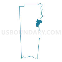
Outline

Summary
| Unique Area Identifier | 522607 |
| Name | Satsuma City Hall |
| County | Mobile County |
| State | Alabama |
| Area (square miles) | 36.34 |
| Land Area (square miles) | 32.60 |
| Water Area (square miles) | 3.74 |
| % of Land Area | 89.71 |
| % of Water Area | 10.29 |
| Latitude of the Internal Point | 30.81571470 |
| Longtitude of the Internal Point | -88.02268160 |
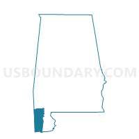
Maps

Graphs
Select a template below for downloading or customizing gragh for Satsuma City Hall, Mobile County, Alabama


Neighbors
Neighoring Voting District (by Name) Neighboring Voting District on the Map
- Bishop St Community College, Mobile County, AL
- Bromley Crossroads Vol. Fire Dept. Substation, Baldwin County, AL
- Chickasaw Auditorium, Mobile County, AL
- Crossroads Durant Chapel Church, Baldwin County, AL
- First Baptist Church of Axis, Mobile County, AL
- Howard Blackwell Lodge, Mobile County, AL
- Plateau Community Center, Mobile County, AL
- Saraland Civic Center, Mobile County, AL
- Shelton Beach Rd. Baptist Church, Mobile County, AL
- Vigor High School, Mobile County, AL
Top 10 Neighboring County Subdivision (by Population) Neighboring County Subdivision on the Map
- Mobile CCD, Mobile County, AL (236,809)
- Daphne CCD, Baldwin County, AL (41,295)
- Bay Minette CCD, Baldwin County, AL (23,604)
Top 10 Neighboring Place (by Population) Neighboring Place on the Map
- Mobile city, AL (195,111)
- Saraland city, AL (13,405)
- Satsuma city, AL (6,168)
- Chickasaw city, AL (6,106)
- Creola city, AL (1,926)
Top 10 Neighboring Unified School District (by Population) Neighboring Unified School District on the Map
- Mobile County School District, AL (399,587)
- Baldwin County School District, AL (182,265)
- Saraland City School District, AL (13,405)
Top 10 Neighboring State Legislative District Lower Chamber (by Population) Neighboring State Legislative District Lower Chamber on the Map
- State House District 102, AL (50,860)
- State House District 96, AL (50,198)
- State House District 98, AL (37,831)
- State House District 97, AL (35,406)
Top 10 Neighboring State Legislative District Upper Chamber (by Population) Neighboring State Legislative District Upper Chamber on the Map
Top 10 Neighboring 111th Congressional District (by Population) Neighboring 111th Congressional District on the Map
Top 10 Neighboring Census Tract (by Population) Neighboring Census Tract on the Map
- Census Tract 107.01, Baldwin County, AL (7,882)
- Census Tract 103, Baldwin County, AL (7,826)
- Census Tract 56, Mobile County, AL (7,164)
- Census Tract 54, Mobile County, AL (4,068)
- Census Tract 12, Mobile County, AL (3,484)
- Census Tract 55, Mobile County, AL (2,973)
- Census Tract 76, Mobile County, AL (2,371)
- Census Tract 53, Mobile County, AL (1,990)
- Census Tract 52, Mobile County, AL (1,534)
- Census Tract 38, Mobile County, AL (1,467)